

Managing Water Runoff from Steep Slopes in the Hills of Fairmount Park
Steep hillside lots in the Fairmount Park neighborhood of West Seattle push enormous volumes of water toward your foundation every time an atmospheric river rolls in off the Pacific. That water does not stop at your property line. It saturates glacial till soil, builds hydrostatic pressure against your basement walls, and can trigger slow-moving slope failure that cracks your foundation long before you see visible damage inside the house. If you own a home on a steep lot in this part of Seattle, this guide gives you the technical framework to stop that process before it costs you a serious amount of money.

Why Seattle Hillsides Fail Faster Than You Think
Seattle sits on a complex geological base shaped by Pleistocene glaciers. The primary soil types in hillside neighborhoods like Queen Anne, Magnolia, and Beacon Hill include glacial till, Lawton Clay, and outwash sand. Each of these behaves differently under saturation, and not one of them drains the way loamy garden soil does.
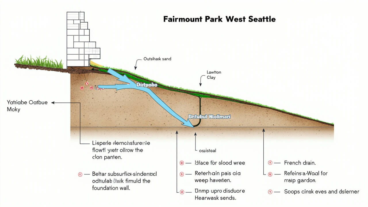
Lawton Clay is the most problematic. It sits beneath many of Seattle’s steep residential lots and acts as an impermeable barrier. Rain water percolates through the upper sandy layers and then hits the clay, where Lawton Clay redirects it laterally, straight toward the nearest foundation. The Seattle Department of Construction and Inspections (SDCI) classifies many of these slopes as Environmentally Critical Areas (ECA) specifically because of this geological profile.
Seattle receives an average of 37 to 39 inches of rain annually. But the volume per storm matters more than the annual figure. A single Pineapple Express event, the atmospheric river system that funnels warm, moisture-heavy air from the Hawaiian Islands into Puget Sound, can dump 3 to 5 inches of rain in 24 hours. Saturated glacial till cannot absorb that volume. The water moves downhill as surface runoff or lateral subsurface flow, and it finds the lowest, most vulnerable point, which is often your foundation or crawl space.. Read more about Professional Crawl Space Encapsulation and Drying for Pinehurst Homeowners.
What Makes Fairmount Park Different from Other Seattle Hillside Neighborhoods
Fairmount Park occupies the southwestern slope of the Pigeon Point ridge system in West Seattle, bounded roughly by SW Charlestown Street to the north, 35th Avenue SW to the east, and the bluff edge above the Duwamish River lowlands to the west and south. This position gives Fairmount Park a distinct drainage challenge that separates it from Queen Anne, Magnolia, and Beacon Hill in ways that matter to anyone managing runoff on these lots.
Unlike Queen Anne, which sheds water in multiple directions toward Lake Union and Puget Sound, Fairmount Park slopes predominantly toward the Duwamish River corridor. That single directional drainage path concentrates subsurface flow along the western edge of the neighborhood, particularly along SW Andover Street, SW Hinds Street, and the blocks immediately east of 34th Avenue SW. Homes on the lower sections of those blocks sit at the collection point for runoff traveling the full vertical drop of the ridge, which reaches grades above 40 percent in several segments near the bluff edge. SDCI’s ECA mapping designates much of the western third of Fairmount Park as a steep slope ECA with a geologically hazardous area buffer, a classification that requires geotechnical review for any grading, drainage modification, or retaining wall work regardless of wall height.
Fairmount Park also sits directly adjacent to the Fairmount Ravine and Puget Creek drainage corridor. Puget Creek runs through a natural ravine system that parallels the southern boundary of the neighborhood before discharging toward the Duwamish estuary. This proximity means that subsurface lateral flow from Fairmount Park lots does not disperse freely into flat terrain. Instead it builds pressure against the ravine walls and the rear foundation lines of homes whose lots back up to the ravine edge.
Homeowners on SW Willow Street and the lower blocks of 35th Avenue SW sit closest to this pressure zone. The combination of a single dominant downslope direction, consistent Lawton Clay geology at depth, proximity to the Puget Creek ravine, and grades that steepen sharply near the bluff edge creates a drainage environment that standard West Seattle or generic Seattle hillside guidance does not fully address.
How Fairmount Park Geology Differs from Magnolia and Beacon Hill
The comparison to Magnolia and Beacon Hill reveals the specific character of Fairmount Park drainage risk rather than a shared generic risk. Magnolia sits on a glacially deposited bluff with significant outwash sand layers above the Lawton Clay contact, which gives the upper soil profile more natural infiltration capacity before water reaches the impermeable layer. Beacon Hill is underlain by a thicker sequence of glacial till with relatively consistent slope grades that make drainage engineering more predictable. Fairmount Park presents a different combination. The Lawton Clay contact in Fairmount Park is shallower on average than in Magnolia, which means lateral redirection of infiltrating water begins closer to the surface.
The slopes in Fairmount Park also transition from moderate to extreme grade over shorter horizontal distances than Beacon Hill, which creates abrupt changes in runoff velocity that concentrate erosion at slope breaks rather than distributing it evenly. The ravine proximity adds a factor absent from most of Queen Anne and Magnolia. Ravine walls in the Puget Creek corridor have a history of small-scale sloughing events after extended wet periods, and the lateral root reinforcement from the ravine vegetation does not extend far enough upslope to stabilize the rear yard areas of homes on the ravine edge. Fairmount Park homeowners near the ravine boundary need slope stabilization measures in addition to drainage interception to address the combined risk of hydrostatic pressure and shallow soil creep.
A drainage approach that works well on a Queen Anne hillside lot with flat or gently graded rear yard will leave a Fairmount Park ravine-edge property exposed to a failure mode that pure drainage engineering does not resolve.
Warning Signs That Your Hillside Drainage Is Failing
You do not need a structural engineer to spot the early indicators of slope drainage failure. These signs show up before the serious structural damage starts, which means you still have time to act preventatively.
- Pooling water at the base of your slope or along your foundation after moderate rain, not just during major storms
- Stair-step cracks in brick or masonry walls, which indicate differential settlement from soil movement
- Leaning or tilting trees and fence posts, a sign that the soil mass itself is slowly migrating downhill
- Soil mounds or bulges on the lower section of your slope, which indicate subsurface water pressure is deforming the ground
- Efflorescence, the white mineral deposits, on your basement or foundation walls, caused by water pushing through concrete
- Doors and windows that stick or no longer close square, indicating foundation movement
- Visible erosion channels or rills cutting through your yard after every rain event
- Soft or spongy ground near your home’s perimeter even days after rain stops
Any one of these signs warrants a professional drainage assessment. Two or more together mean you should act immediately. Homeowners in West Seattle and Magnolia who have ignored these signs have faced far more expensive outcomes, including full foundation underpinning and mold remediation inside finished basements.
Proven Drainage Solutions for Steep Seattle Lots
French Drains and Subsurface Trenching
A French drain intercepts lateral groundwater before it reaches your foundation. A contractor trenches a sloped channel around the uphill perimeter of your home, lines it with geotextile filter fabric, fills it with clean crushed rock, and installs a perforated pipe at the bottom. That pipe carries the captured water to a safe discharge point, either a municipal storm drain connection or a dispersal area away from all structures.
On Seattle hillside lots, the trench depth matters enormously. You need to get below the interface where lateral flow occurs, which usually means cutting down to the Lawton Clay layer. Shallow French drains fail quickly on steep lots because they only capture surface flow and miss the subsurface movement that causes foundation pressure.
Catch Basins and Point Discharge Systems
Where surface runoff concentrates into a defined flow path, a catch basin captures that water at the collection point and channels it into a pipe system. Point discharge systems route that pipe to a single outlet at a safe distance from your foundation, rather than allowing sheet flow to spread across your lot.
Sheet flow, the broad shallow spread of water across a slope surface, creates widespread saturation and erosion. Converting sheet flow to point discharge through a piped system gives you control over where that water ends up. Seattle’s King County drainage regulations require that any new discharge point must not increase downstream property flooding, so proper engineering and permitting matter here.
Retaining Walls with Weep Holes
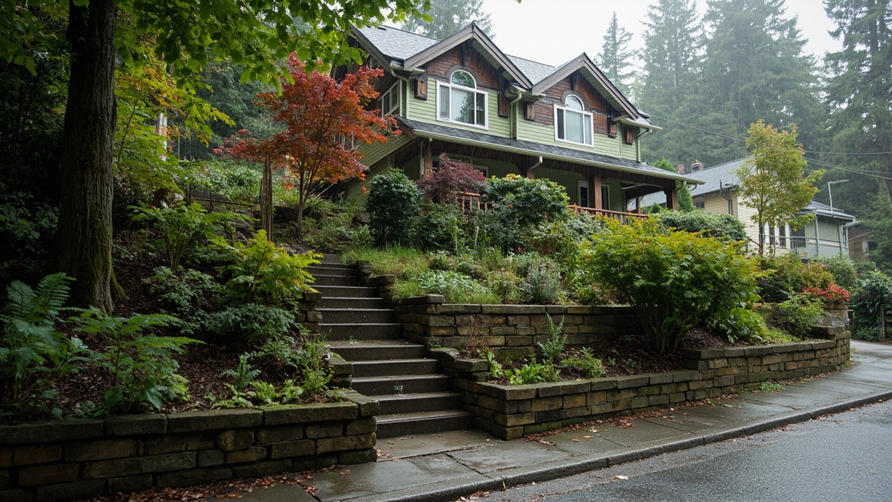
Retaining walls terrace steep slopes into flat or gently graded segments, which slows runoff velocity and reduces the volume of water hitting any single point of your lot. But a retaining wall without proper drainage behind it will fail. Hydrostatic pressure, the force that saturated soil exerts against a structure, can crack or overturn a wall the builder did not design to relieve hydrostatic pressure.
Weep holes, the small openings near the base of a retaining wall, allow that accumulated pressure to escape. A well-built wall also includes a gravel backfill layer and a perforated drain pipe behind it that connects to your overall drainage system. Walls over 4 feet in height require a permit from SDCI, and many hillside lots in the ECA overlay require additional geotechnical review before any wall work can begin.
Rain Gardens and Native Plant Bioswales
A rain garden is a shallow, vegetated depression that captures runoff and allows it to percolate slowly into the soil. On a steep hillside, you site rain gardens at points where runoff naturally collects before it gains speed. The key to making them work in Seattle’s clay-heavy soils is amending the basin with a sand and compost mix that improves infiltration rates.
Bioswales function similarly but use a linear channel design to slow and filter runoff as it moves across your slope. Planting these with deep-rooted Pacific Northwest natives, including red-osier dogwood, salal, and sword fern, builds long-term soil stabilization. Deep root systems from native plants break through compacted clay layers and create channels for water infiltration that grass alone cannot provide.
Geotextile Soil Stabilization Fabrics
Geotextile fabrics and erosion control blankets give your slope immediate protection while vegetation establishes. These materials cover bare soil, prevent the surface erosion that rainfall impact triggers, and hold seeds or transplants in place on steep grades. On slopes above 40 percent grade, geotextiles combined with soil bioengineering techniques, live stakes of native willows driven directly into the slope, create structural root networks that actively hold the soil mass.
Seattle SDCI Requirements for Hillside Drainage Work
Any significant grading, drainage installation, or retaining wall construction on a Seattle hillside requires engagement with SDCI. Properties within an Environmentally Critical Area designation face additional requirements, including a report that a licensed geotechnical engineer prepares and certifies before any work begins. The SDCI’s ECA regulations exist because slope failure in Seattle is not a theoretical risk. Events in Magnolia and along the Beacon Hill escarpment have demonstrated real consequences for both property owners and adjacent lots.
The permit process for drainage modifications on steep lots typically requires a site plan showing existing and proposed grade contours, drainage calculations demonstrating no increase in downstream flow rates, and a stormwater management plan. Your contractor should be familiar with Washington State Department of Ecology stormwater standards, since King County and Seattle both reference state guidelines in their local drainage codes.
Skipping permits on hillside drainage work creates two serious problems. First, unpermitted retaining walls and drainage systems have no engineering review, meaning they fail at a higher rate. Second, unpermitted work can block your ability to sell the property or make insurance claims related to subsequent water damage.
Comparing Drainage Solutions by Slope Grade and Risk Level
| Solution | Best Slope Grade | Primary Function | SDCI Permit Required | Maintenance Frequency |
|---|---|---|---|---|
| French Drain | Any grade | Intercepts subsurface lateral flow | Often yes, check ECA status | Annual inspection, flush every 3 to 5 years |
| Catch Basin and Pipe | 15 to 40 percent | Captures concentrated surface runoff | Yes if connecting to storm system | Clear debris before each rain season |
| Retaining Wall with Weep Holes | Over 20 percent | Terracing and hydrostatic pressure relief | Yes for walls over 4 feet | Check weep holes annually |
| Rain Garden | Under 20 percent | Infiltration and runoff slowing | Generally no | Seasonal planting maintenance |
| Bioswale with Native Plants | 10 to 30 percent | Filters and slows sheet flow | Depends on size and location | Annual pruning, replanting as needed |
| Geotextile and Erosion Blanket | Over 30 percent | Immediate surface erosion control | No if no grading | Check after major storms for displacement |
Preventative Drainage vs. Emergency Restoration Costs
| Scenario | Typical Scope | Primary Risk if Skipped | Timeline |
|---|---|---|---|
| French drain installation on a 60-foot slope | Trenching, pipe, gravel, geotextile, discharge point connection to storm system | Lateral subsurface flow reaches foundation wall and builds hydrostatic pressure leading to cracking | 2 to 5 days of contractor work |
| Engineered retaining wall with drainage | Geotechnical report, SDCI permits, wall construction, gravel backfill, drain pipe behind wall | Unrelieved hydrostatic pressure cracks or overturns the wall within 3 to 5 wet seasons | 2 to 6 weeks including permitting |
| Basement water extraction after slope failure | Standing water removal, commercial drying equipment deployment, daily moisture monitoring until clearance | Mold colonization in floor joists and wall framing begins within 24 to 48 hours of saturation | 3 to 7 days of active drying |
| Mold remediation after unaddressed seepage | Containment barrier installation, demolition of affected drywall and insulation, antifungal treatment, air scrubbing | Ongoing airborne spore load creates health risk and spreads contamination to unaffected rooms | 1 to 3 weeks depending on extent |
| Foundation crack repair with waterproofing | Epoxy injection for active cracks or full exterior waterproofing membrane with drainage mat installation | Untreated cracks widen each freeze-thaw cycle and allow soil fines to migrate into the basement | Variable by method |
A Fairmount Park homeowner on SW Hinds Street who invested roughly 8,000 dollars in a French drain system along a 60-foot upslope perimeter avoided the foundation crack repair and mold remediation that a neighbor two lots downhill faced the following winter, a combined restoration scope that ran past 35,000 dollars and took three weeks to complete. That comparison illustrates what early drainage investment accomplishes on these specific lots.
Understanding What Happens After Slope Drainage Fails
Even with good drainage infrastructure, a severe Pineapple Express event or a prolonged wet season can push water into your structure. When that happens, the clock starts immediately. Water that sits in a crawl space, basement, or wall cavity begins to grow mold within 24 to 48 hours in Seattle’s cool, humid environment. The persistent cloud cover and high relative humidity that characterize Seattle winters slow natural evaporation to near zero, which means wet structural materials stay wet far longer than they would in a drier climate.
Water intrusion from hillside runoff typically enters through foundation wall cracks, the joint between the footing and the foundation wall, window wells, and crawl space vents. It then wicks into floor joists, subfloor sheathing, and wall framing. In historic Craftsman homes common in neighborhoods like Queen Anne and Ballard, older lath and plaster construction holds moisture differently than modern drywall, and the damage can spread further before it becomes visible.
Knowing the sequence of damage helps you prioritize your inspections. Foundation wall pressure builds first and shows up as efflorescence or hairline cracks. Floor joist saturation follows if the crawl space floods. Wall cavity moisture comes last but causes the most expensive remediation because you need thermal imaging equipment to detect it reliably. Understanding this sequence tells you which part of your home to check first after a major storm and helps you have a more productive conversation with any professional you bring in for an assessment.
If you want to understand what slow moisture intrusion does to a home over time, reading about what slow moisture intrusion does to a Magnolia basement gives you a clear picture of how cumulative damage accumulates before it becomes visible. The same principles apply directly to hillside seepage situations in Fairmount Park.
Sump Pump Integration for Hillside Lots
In situations where subsurface drainage volume exceeds what gravity discharge can handle, a sump pump system in your crawl space or basement adds active water management to your passive drainage network. The pump activates when collected water reaches a set level and discharges it away from your foundation through a dedicated pipe. Seattle building code requires that sump discharge not connect to the sanitary sewer system, so your contractor must route discharge to an appropriate stormwater connection or infiltration area.
Pairing a sump pump with a battery backup system is critical on Seattle hillside lots. The storms that saturate your slope most heavily are the same storms that knock out power. A pump that stops working during a power outage on the night of a major atmospheric river event provides no protection when you need it most.
Building Your Drainage Knowledge Before You Call a Contractor
The most effective conversations with drainage contractors and geotechnical engineers happen when you arrive with specific knowledge about your lot. Before you schedule any professional visit, walk your property after the next moderate rain and note exactly where water pools, where it flows, and where the soil stays wet longest. Take photos and record the locations relative to your foundation. That documentation gives an engineer or contractor a starting point that saves time and sharpens their recommendations.
You should also pull your property’s ECA status from the SDCI website before any contractor conversation. Knowing whether you fall inside a steep slope ECA, a geologically hazardous area buffer, or the Puget Creek ravine setback zone shapes what solutions are even available to you under current permit requirements. A contractor who does not ask about your ECA status in the first conversation is a contractor who may not be familiar with the specific permit pathway your lot requires.
If you are dealing with an insurance claim related to hillside water intrusion, understanding the documentation process before water enters your home positions you far better than learning it under pressure. Reading through how to handle a water damage insurance claim in Beacon Hill gives you a clear breakdown of what that process looks like. And if you suspect that moisture has been sitting inside your walls longer than you realized, understanding how to identify hidden mold behind drywall will help you know what questions to ask before any remediation work begins.
Frequently Asked Questions
Does Seattle classify steep hillside lots differently for drainage permits?
Yes. The Seattle Department of Construction and Inspections designates many steep lots as Environmentally Critical Areas. Drainage modifications in ECA zones require a geotechnical report and additional permit review. Check your property’s ECA status on the SDCI website before beginning any grading or drainage work.
How deep does a French drain need to be on a Seattle hillside to work properly?
On Seattle glacial till and Lawton Clay soils, an effective French drain typically needs to reach the interface between the permeable upper layer and the impermeable clay layer below. That depth varies by site but commonly falls between 18 and 48 inches. A geotechnical assessment gives you the accurate depth for your specific lot.
What is the difference between hydrostatic pressure and surface runoff damage?
Surface runoff flows across your yard and can erode soil and enter your home through openings above grade. Hydrostatic pressure builds when saturated soil pushes outward and downward against your foundation or retaining wall. Both damage homes on Seattle hillsides, and a complete drainage system addresses both issues rather than treating them separately.
Are Fairmount Park lots more likely to need geotechnical review than lots in other Seattle neighborhoods?
Yes, for lots in the western third of Fairmount Park near the bluff edge and the Puget Creek ravine corridor. The combination of steep grade transitions, shallow Lawton Clay contact, and proximity to the ravine system places many of these lots inside SDCI’s steep slope ECA and geologically hazardous area designations. That combination triggers geotechnical review requirements that a lot in a gentler part of West Seattle or a mid-slope Beacon Hill property would not face. Checking your specific parcel on the SDCI mapping tool before any project planning is the right first step.
Evergreen Water Damage Restoration Seattle responds 24 hours a day, 7 days a week, to water intrusion events across the greater Seattle metro. The team serves Fairmount Park, Queen Anne, Magnolia, Shoreline, West Seattle, Bellevue, and surrounding communities with full structural drying and restoration services built for Seattle’s wet climate and challenging soil conditions. If water has already entered your structure, a free assessment from a restoration professional gives you accurate moisture mapping and a clear picture of what remediation your home actually needs before any work begins.